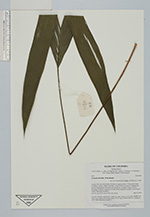
| Collector | Bernal, R. |
| Number | 4516 |
| Collected with | H. Balslev, L. Mesa, D. Pedersen, J.C. Garcés, F.J. Horacio, N. Morueta, L. Skov Jensen, Mateo Navarro, Pedro Sánchez |
| Country | Colombia |
| Subpart | Guainía |
| County | |
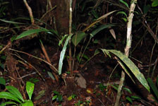
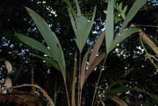
| Locality | Río Guaviare S bank, Barrancón, approximately 3.5 km inland from rivershore, 142 km WNW of Inírida, 14 km WNW of Arrecifal. Tropical rain forest on flat ground with many wet depressions, probably transition from floodplain to terrace. Canopy 20 m tall, forest dominated by palms (Oenocarpus bataua, Manicaria saccifera). |
| Coordinates | 3° 36' 6.4'' N 69° 10' 51.2'' W |
| Minimum elevation (m) | 130 |
| Maximum elevation (m) | 0 |
| Start date | 2009/09/19 |
| End date | 0/00/00 |
| Family | Arecaceae |
| Identification | Geonoma maxima (Poit.)Kunth |
| Determined by | R. Bernal & H. Balslev |
| Identification qualifier | |
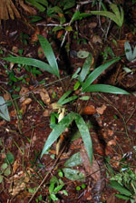
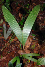
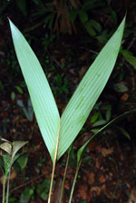
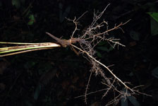
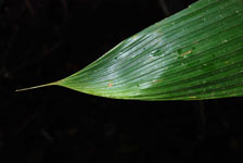
| Field notes | Juvenile. Solitary, acaulescent, understory palm. Leaves 5 per stem; sheaths 5 cm long, open; petiole 45 cm long; rachis 10 cm long. Transect HB1017, subunit no. 059; UTM 19N-479910-398110. |
|
 Other records of Geonoma maxima