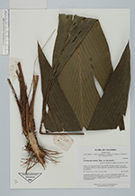
| Collector | Bernal, R. |
| Number | 4511 |
| Collected with | H. Balslev, L. Mesa, D. Pedersen, J.C. Garcés, F.J. Horacio, N. Morueta, L. Skov Jensen, M. Moreno |
| Country | Colombia |
| Subpart | Guainía |
| County | |
| Locality | Río Guaviare S bank, 126 km WNW of Inírida, 2 km SE of Arrecifal. Tall tropical rainforest on top of sandy hills, dominated by Attalea luetzelbergii in the understory. |
| Coordinates | 3° 37' 31.4'' N 69° 2' 26.9'' W |
| Minimum elevation (m) | 146 |
| Maximum elevation (m) | 0 |
| Start date | 2009/09/16 |
| End date | 0/00/00 |
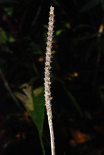
| Family | Arecaceae |
| Identification | Geonoma macrostachys var. macrostachys Mart. |
| Determined by | R. Bernal & H. Balslev |
| Identification qualifier | |
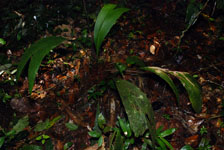
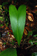
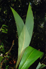
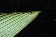
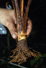
| Field notes | Acaulescent, understory palm. Leaves 7 per stem; sheath open; sheaths and petiole 45 cm long, with margined cross section; rachis 47 cm; lamina entire, flat. Inflorescence interfoliar. Transect HB1014, subunit no. 062; UTM 19N-495467-400721. |
|