| Collector | Bernal, R. |
| Number | 4510 |
| Collected with | H. Balslev, L. Mesa, D. Pedersen, J.C. Garcés, F.J. Horacio, N. Morueta, L. Skov Jensen, M. Moreno |
| Country | Colombia |
| Subpart | Guainía |
| County | |
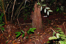
| Locality | Río Guaviare S bank, 126 km WNW of Inírida, 2 km SE of Arrecifal. Tall tropical rainforest on top of sandy hills, dominated by Attalea luetzelbergii in the understory. |
| Coordinates | 3° 37' 32.8'' N 69° 2' 26.2'' W |
| Minimum elevation (m) | 146 |
| Maximum elevation (m) | 0 |
| Start date | 2009/09/16 |
| End date | 0/00/00 |
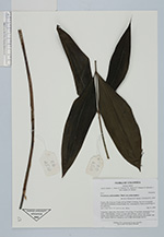
| Family | Arecaceae |
| Identification | Desmoncus polyacanthos var. polyacanthos Mart. |
| Determined by | R. Bernal & H. Balslev |
| Identification qualifier | |
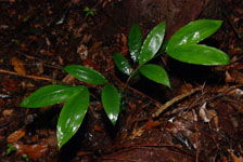
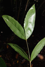
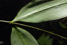
| Field notes | Understory, liana palm. Stem aerial, 0.76 m long, 0.3 cm thick; internodes 13 cm long, > stem diameter, brown, covered with leaf bases. Leaves 3 per stem; sheaths open; petiole round; rachis 47 cm long; lamina pinnate, flat; pinnae 3 per side. Transect HB1014, subunit no. 053; UTM 19N-495489-400762. |
|
 Other records of Desmoncus polyacanthos var. polyacanthos