| Collector | Bernal, R. |
| Number | 4509 |
| Collected with | H. Balslev, L. Mesa, D. Pedersen, J.C. Garcés, F.J. Horacio, N. Morueta, L. Skov Jensen, M. Moreno |
| Country | Colombia |
| Subpart | Guainía |
| County | |
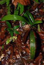
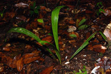
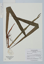
| Locality | Río Guaviare S bank, 126 km WNW of Inírida, 2 km SE of Arrecifal. Tall tropical rainforest on top of sandy hills, dominated by Attalea luetzelbergii in the understory. |
| Coordinates | 3° 37' 36.3'' N 69° 2' 24.2'' W |
| Minimum elevation (m) | 156 |
| Maximum elevation (m) | 0 |
| Start date | 2009/09/16 |
| End date | 0/00/00 |
| Family | Arecaceae |
| Identification | Attalea microcarpa Mart. |
| Determined by | R. Bernal & H. Balslev |
| Identification qualifier | |
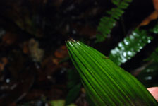
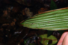
| Field notes | Seedling of solitary, understory, rosulate, acaulescent palm. Leaves 3 per stem. Transect HB1014, subunit no. 029; UTM 19N-495551-400870. |
|
 Other records of Attalea microcarpa