| Collector | Bernal, R. |
| Number | 4508 |
| Collected with | H. Balslev, L. Mesa, D. Pedersen, J.C. Garcés, F.J. Horacio, N. Morueta, L. Skov Jensen, M. Moreno |
| Country | Colombia |
| Subpart | Guainía |
| County | |
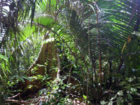
| Locality | Río Guaviare S bank, 126 km WNW of Inírida, 2 km SE of Arrecifal. Tall tropical rainforest on top of sandy hills, dominated by Attalea luetzelbergii in the understory. |
| Coordinates | 3° 37' 42'' N 69° 2' 23.2'' W |
| Minimum elevation (m) | 158 |
| Maximum elevation (m) | 0 |
| Start date | 2009/09/16 |
| End date | 0/00/00 |
| Family | Arecaceae |
| Identification | Attalea microcarpa Mart. |
| Determined by | R. Bernal & H. Balslev |
| Identification qualifier | |
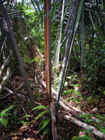
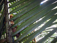
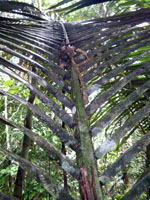
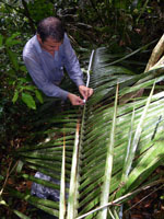
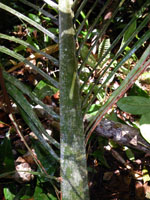
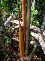
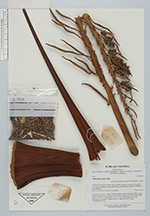
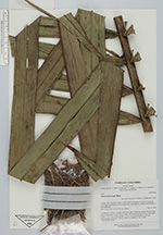
| Field notes | Acaulescent, solitary, rosulate, understory palm. Sheath and petiole 160 cm long; petiole margined in cross section; rachis 490 cm long; pinnae 103 per side, basal pinna 75 x 0.6 cm, middle pinnae 117 x 6.0 cm, apical pinna 22 x 0.4 cm. Inflorescence interfoliar. Transect HB1014, to transect; UTM 19N-495583-401045. |
|
 Other records of Attalea microcarpa