| Collector | Bernal, R. |
| Number | 4507 |
| Collected with | H. Balslev, L. Mesa, D. Pedersen, J.C. Garcés, F.J. Horacio, N. Morueta, L. Skov Jensen, M. Moreno |
| Country | Colombia |
| Subpart | Guainía |
| County | |
| Locality | Río Guaviare S bank, 126 km WNW of Inírida, 1 km E of Arrecifal. Tall tropical rainforest on red clay hills and flat sandy hill tops. |
| Coordinates | 3° 38' 9.6'' N 69° 2' 48.3'' W |
| Minimum elevation (m) | 145 |
| Maximum elevation (m) | 0 |
| Start date | 2009/09/16 |
| End date | 0/00/00 |
| Family | Arecaceae |
| Identification | Attalea microcarpa Mart. |
| Determined by | R. Bernal & H. Balslev |
| Identification qualifier | |
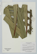
| Field notes | Solitary, understory, rosulate, acaulescent palm. Leaves 8 per stem; sheath plus petiole 205 cm; petiole margined in cross section; rachis 436 cm long; lamina pinnate, flat, with 96 pinnae per side, basal pinna 53 cm, middle pinna 95 cm, apical pinna 21 cm long. Transect HB1013, subunit no. 054; UTM 19N-494810-401893. |
|
 Other records of Attalea microcarpa