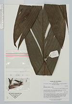
| Collector | Bernal, R. |
| Number | 4506 |
| Collected with | H. Balslev, L. Mesa, D. Pedersen, J.C. Garcés, F.J. Horacio, N. Morueta, L. Skov Jensen, M. Moreno |
| Country | Colombia |
| Subpart | Guainía |
| County | |
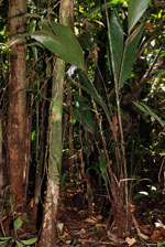
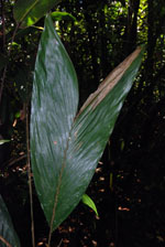
| Locality | Río Guaviare S bank, 126 km WNW of Inírida, 1 km E of Arrecifal. Tall tropical rainforest on red clay hills and flat sandy hill tops. |
| Coordinates | 3° 38' 3'' N 69° 2' 47.1'' W |
| Minimum elevation (m) | 146 |
| Maximum elevation (m) | 0 |
| Start date | 2009/09/16 |
| End date | 0/00/00 |
| Family | Arecaceae |
| Identification | Bactris hirta var. hirta Mart. |
| Determined by | R. Bernal & H. Balslev |
| Identification qualifier | |
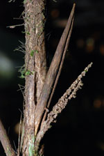
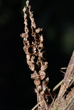
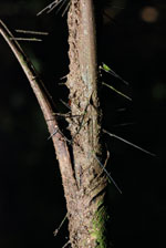
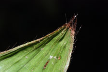
| Field notes | Cespitose, undertsory palm. Stem aerial, 3.5 m high, 1 cm thick; internodes 8 cm long, > stem diameter, smooth. Leaves 5 per stem; sheaths 20 cm long, open, with 0.5-2 cm long, black spines, petiole 23 cm long, with black, 2 cm long spines; rachis 36 cm; lamina entire, flat. Inflorescence infrafoliar. Transect HB1013, subunit no. 085; UTM 19N-494845N-401689. |
|