| Collector | Bernal, R. |
| Number | 4505 |
| Collected with | H. Balslev, L. Mesa, D. Pedersen, J.C. Garcés, F.J. Horacio, N. Morueta, L. Skov Jensen, M. Moreno |
| Country | Colombia |
| Subpart | Guainía |
| County | |
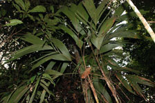
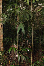
| Locality | Río Guaviare S bank, 126 km WNW of Inírida, 1 km E of Arrecifal. Tall tropical rainforest on red clay hills and flat sandy hill tops. |
| Coordinates | 3° 38' 13.5'' N 69° 2' 48.6'' W |
| Minimum elevation (m) | 145 |
| Maximum elevation (m) | 0 |
| Start date | 2009/09/16 |
| End date | 0/00/00 |
| Family | Arecaceae |
| Identification | Geonoma maxima var. maxima (Poit.)Kunth |
| Determined by | R. Bernal & H. Balslev |
| Identification qualifier | |
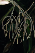
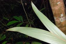
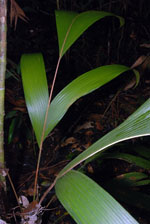
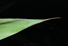
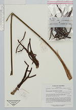
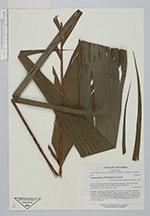
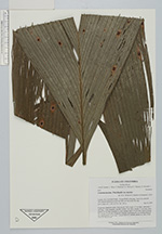
| Field notes | Cespitose, understory palm. Stem aerial, 3.18 m high, 2.5 cm diam; internodes 7 cm long, > stem diameter, smooth; Leaves 7 per stem; sheaths 13 cm long, open; petiole 45 cm long, margined in cross section; rachis 63 cm long; lamina pinnate, flat; pinnae 35 per side, irregularly inserted, basal pinna 81 cm, middle pinna 59 cm, apical pinna 75 cm long. Transect HB1013, outside subunit no. 036;, UTM 19N-494798-401938. |
|