AAU Herbarium Database |
| New Search Modify Search |
| Collector | Bernal, R. |
| Number | 4503 |
| Collected with | H. Balslev, L. Mesa, D. Pedersen, J.C. Garcés, F.J. Horacio, N. Morueta, L. Skov Jensen, M. Moreno |
| Country | Colombia |
| Subpart | Guainía |
| County | |
| Locality | Río Guaviare S bank, 126 km WNW of Inírida, 1 km E of Arrecifal. Tall tropical rainforest on red clay hills and flat sandy hill tops. |
| Coordinates | 3° 38' 13.6'' N 69° 2' 49.2'' W |
| Minimum elevation (m) | 138 |
| Maximum elevation (m) | 0 |
| Start date | 2009/09/16 |
| End date | 0/00/00 |
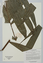
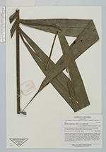
| Family | Arecaceae |
| Identification | Bactris acanthocarpa var. acanthocarpa Mart. |
| Determined by | R. Bernal & H. Balslev |
| Identification qualifier | |
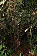
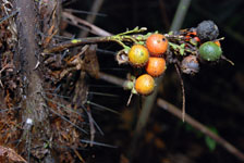
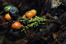
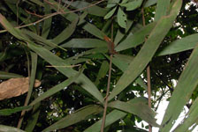
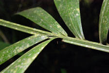
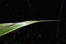
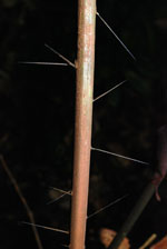
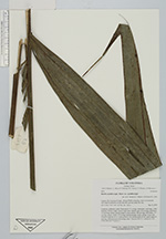
| Field notes | Cespitose, understory palm. Stem aerial, 0.5 m long; internodes 1 cm long, < stem diameter, brown, rough. Leaves 6 per stem; sheaths open, 42 cm long, with black, 2-6 cm long, spines; petiole round in cross section, 180 cm long, with black, 2.5 cm long, spines; rachis 1.97 m long; lamina pinnate, bushy; pinnae 16 per side, inserted in groups of 1-4, basal pinna 64 cm, middle pinna 50 cm, apical pinna 41 cm long. Infructescence with orange fruits. Transect HB1013, subunit no. 020; UTM 19N-494779-402015. |
| |
 Other records of Bactris acanthocarpa var. acanthocarpa Other records of Bactris acanthocarpa var. acanthocarpaThe map displays only records from the Aarhus Herbarium Database. The records may not represent the full distribution of Bactris acanthocarpa var. acanthocarpa |
| New Search Modify Search |