| Collector | Bernal, R. |
| Number | 4499 |
| Collected with | H. Balslev, L. Mesa, D. Pedersen, J.C. Garcés, F.J. Horacio, N. Morueta, L. Skov Jensen, M. Moreno |
| Country | Colombia |
| Subpart | Guainía |
| County | |
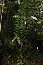
| Locality | Río Guaviare S bank, 126 km WNW of Inírida, 1 km E of Arrecifal. Tall tropical rainforest on red clay hills and flat sandy hill tops. |
| Coordinates | 3° 38' 14.3'' N 69° 2' 48.8'' W |
| Minimum elevation (m) | 134 |
| Maximum elevation (m) | 0 |
| Start date | 2009/09/16 |
| End date | 0/00/00 |
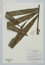
| Family | Arecaceae |
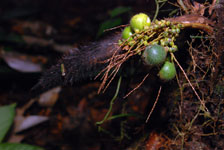
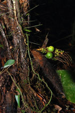
| Identification | Bactris acanthocarpa var. acanthocarpa Mart. |
| Determined by | R. Bernal & H. Balslev |
| Identification qualifier | |
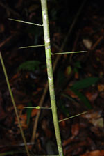
| Field notes | Understory palm. Leaves 6 per stem; petiole 109 cm long, round in cross section, with 1-5.5 cm long spines; rachis 116 cm long; lamina pinnate, bushy with pinnae in groups of 1-3; basal pinna 52 cm long, midle pinna 50 cm, apical pinna 46 cm long. Transect HB1013, subunit 015; UTM 19N-494793-402037. |
|
 Other records of Bactris acanthocarpa var. acanthocarpa