| Collector | Bernal, R. |
| Number | 4491 |
| Collected with | H. Balslev, L. Mesa, D. Pedersen, J.C. Garcés, F.J. Horacio, N. Morueta, L. Skov Jensen, E. Romero |
| Country | Colombia |
| Subpart | Guainía |
| County | |
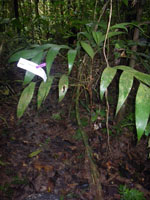
| Locality | Río Guaviare N bank, Piedra Veradal, 9 km NE of Cumaral, 100 km WNW of Inírida. Tropical rainforest on floodplain, near large (20x40 m) rock sticking 15 m out of the ground. |
| Coordinates | 3° 44' 49.8'' N 68° 49' 46.7'' W |
| Minimum elevation (m) | 113 |
| Maximum elevation (m) | 0 |
| Start date | 2009/09/14 |
| End date | 0/00/00 |
| Family | Arecaceae |
| Identification | Geonoma deversa (Poit.)Kunth |
| Determined by | R. Bernal & H. Balslev |
| Identification qualifier | |
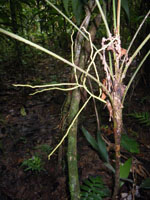
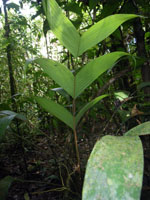
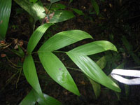
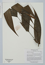
| Field notes | Cespitose, understory palm. Stem aerial, 32 cm high, 1 cm thick; internodes 2 cm long, > stem diameter, brown-yellow. Leaves 9 per stem; sheaths 13 cm long, open; petiole 23 cm long, margined in cross-section: rachis 29 cm long; lamina pinnate, flat, with 3 segments per side; basal pinna 26 cm, midle pinna 25 cm, apical pinna 26 cm long. Inflorescence infrafoliar; rachillae 6. Specimen includes adult and seedling. Transect HB1012, subunit no. 029;, UTM 19N-518918-414187. |
|