| Collector | Bernal, R. |
| Number | 4483 |
| Collected with | H. Balslev, L. Mesa, D. Pedersen, J.C. Garcés, F.J. Horacio, N. Morueta, L. Skov Jensen, E. Ramirez, R. M. Chipiaje |
| Country | Colombia |
| Subpart | Guainía |
| County | |
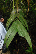
| Locality | Río Guaviare S bank, 4.8 km SE of Pto. Esperanza, 50 km WNW of Inírida. Tropical rainforest on flood plain. |
| Coordinates | 3° 51' 41.3'' N 68° 23' 10.5'' W |
| Minimum elevation (m) | 99 |
| Maximum elevation (m) | 0 |
| Start date | 2009/09/11 |
| End date | 0/00/00 |
| Family | Arecaceae |
| Identification | Geonoma maxima var. maxima (Poit.)Kunth |
| Determined by | R. Bernal & H. Balslev |
| Identification qualifier | |
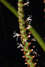
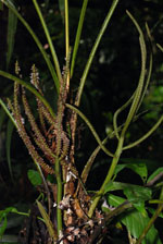
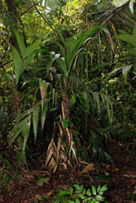
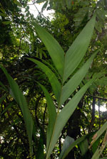
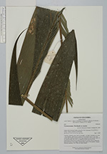
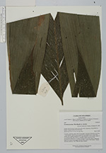
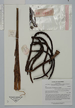
| Field notes | Cespitose, understory palm. Stem 105 cm high, 3 cm thick; internodes 6 cm long, > stem diameter, yellow-brown, smooth. No crownshaft. Leaves 13 per stem; sheaths open; sheath and petiole 56 cm long, margined in cross-section; rachis 75 cm; lamina pinnate, flat, with 2-6, irregularly inserted, pinnae per side. Inflorescence with flowers at anthesis; prophyll 32 cm long, papery; peduncular bract 30 cm long, brown, papery; flowers white, sunken in the rachilla. Transect HB1008, subunit no. 030; UTM 19N-56814-426839. |
|