| Collector | Bernal, R. |
| Number | 4478 |
| Collected with | H. Balslev, L. Mesa, D. Pedersen, J.C. Garcés, F.J. Horacio, N. Morueta, L. Skov Jensen, M. Perez |
| Country | Colombia |
| Subpart | Vichada |
| County | |
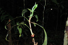
| Locality | Río Guaviare N bank, 2 km NE of Sejal, 46 km WNW of Inírida. Tropical rainforest on terra firme terrace, in large part with a network of 1 m deep hollows separated by 1 m broad "islands" of dry areas, all with thick organic layer; many slender stems, canopy 20-30 m. |
| Coordinates | 4° 0' 25.4'' N 68° 19' 14.4'' W |
| Minimum elevation (m) | 114 |
| Maximum elevation (m) | 0 |
| Start date | 2009/09/09 |
| End date | 0/00/00 |
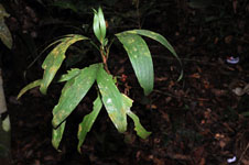
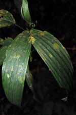
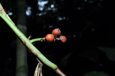
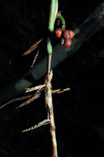
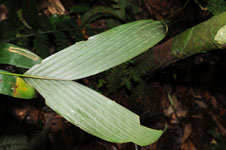
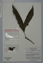
| Family | Arecaceae |
| Identification | Bactris simplicifrons Mart. |
| Determined by | R. Bernal & H. Balslev |
| Identification qualifier | |
| Field notes | Solitary, understory palm. Stem 1.1 m high; internodes 3.8 cm long, > than stem diameter, smooth. Leaves 5 per stem; sheaths open, 8 cm long; petiole 4 cm long, margined in cross-section; rachis 6.5 cm long; lamina entire. Infructescence infrafoliar. Fruits red. Transect HB1006, subunit no. 088; UTM 575411-442939. |
|