| Collector | Bernal, R. |
| Number | 4477 |
| Collected with | H. Balslev, L. Mesa, D. Pedersen, J.C. Garcés, F.J. Horacio, N. Morueta, L. Skov Jensen, M. Perez |
| Country | Colombia |
| Subpart | Vichada |
| County | |
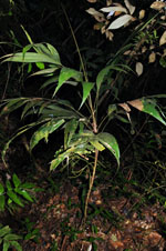
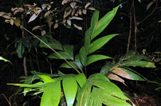
| Locality | Río Guaviare N bank, 2 km NE of Sejal, 46 km WNW of Inírida. Tropical rainforest on terra firme terrace, in large part with a network of 1 m deep hollows separated by 1 m broad "islands" of dry areas, all with thick organic layer; many slender stems, canopy 20-30 m. |
| Coordinates | 4° 0' 14.4'' N 68° 19' 12.3'' W |
| Minimum elevation (m) | 105 |
| Maximum elevation (m) | 0 |
| Start date | 2009/09/09 |
| End date | 0/00/00 |
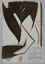
| Family | Arecaceae |
| Identification | Geonoma deversa (Poit.)Kunth |
| Determined by | R. Bernal & H. Balslev |
| Identification qualifier | |
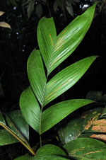
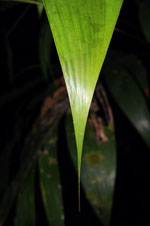
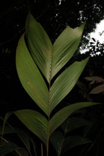
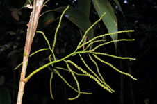
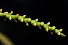
| Field notes | Solitary, understory palm. Stem 1.2 m high, 1.3 cm thick; internodes 3 cm long, > stem diameter, light brown. Leaves 13 per stem, sheaths open; petiole and sheath 28 cm long, margined in cross-section; rachis 42 cm long; pinnae 3 per side, basal pinna 33 cm, middle pinna 35 cm, apical pinna 38 cm long. Inflorescence rachis 19 cm long; rachillae 11 per rachis, 13-20 cm long; flowers cream colored, sunken in rachilla. Transect HB1006, subunit no. 016; UTM 19N-575477-442602. |
|