| Collector | Bernal, R. |
| Number | 4473 |
| Collected with | H. Balslev, L. Mesa, D. Pedersen, J.C. Garcés, F.J. Horacio, N. Morueta, L. Skov Jensen, M. Perez |
| Country | Colombia |
| Subpart | Vichada |
| County | |
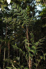
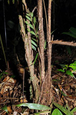
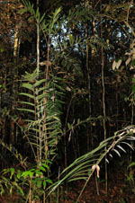
| Locality | Río Guaviare N bank, 2 km N of Sejal, 49 km WNW of Inírida. Tropical rainforest on not-innundated, high terrace, with canopy 20-30 m tall; many slender stems and few large trees. |
| Coordinates | 4° 0' 28.8'' N 68° 20' 20.7'' W |
| Minimum elevation (m) | 108 |
| Maximum elevation (m) | 0 |
| Start date | 2009/09/08 |
| End date | 0/00/00 |
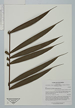
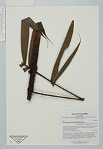
| Family | Arecaceae |
| Identification | Bactris hirta var. pectinata (Mart.)Govaerts |
| Determined by | R. Bernal & H. Balslev (COL&AAU), 2009 |
| Identification qualifier | |
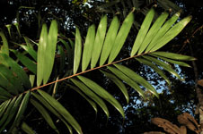
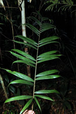
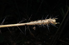
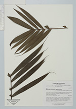
| Field notes | Understory palm. Stem 2.5 m high, 1 cm thick. Leaves 7 per stem; sheaths 15 cm long, spiny; petiole 30 cm long, margined in cross-section, with few spines; rachis 68.5 cm long; lamina pinnate, bushy, hairy; pinnae 18-20 per side, in groups of 2-5; basal pinna 19.5 cm, middle pinna 21.5 cm, apical pinna 12 cm long. Transect HB1005, subunit no. 067; UTM 19N 573367-443042. |
|
 Other records of Bactris hirta var. pectinata