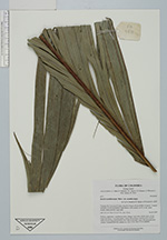
| Collector | Bernal, R. |
| Number | 4471 |
| Collected with | H. Balslev, L. Mesa, D. Pedersen, J.C. Garcés, F.J. Horacio, N. Morueta, L. Skov Jensen, M. Perez |
| Country | Colombia |
| Subpart | Vichada |
| County | |
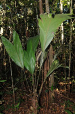
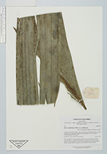
| Locality | Río Guaviare N bank, 2 km N of Sejal, 49 km WNW of Inírida. Tropical rainforest on not-innundated, high terrace, with canopy 20-30 m tall; many slender stems and few large trees. |
| Coordinates | 4° 0' 22.5'' N 68° 20' 25.1'' W |
| Minimum elevation (m) | 105 |
| Maximum elevation (m) | 0 |
| Start date | 2009/09/08 |
| End date | 0/00/00 |
| Family | Arecaceae |
| Identification | Bactris acanthocarpa var. acanthocarpa Mart. |
| Determined by | R. Bernal & H. Balslev |
| Identification qualifier | |
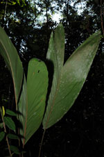
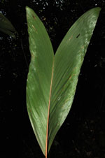
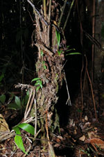
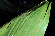
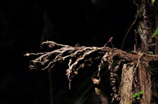
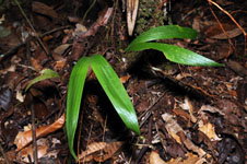
| Field notes | Solitary, understory, acaulescent palm. Leaves 5 per stem; sheths open, 25 cm long, with black, 3 cm long spines; petiole 98 cm long, round in cross-section; rachis 63 cm long; lamina entire, flat, with 16 primary veins. Old infructescence present. Transect HB1005, subunit no. 019; UTM 19N-573232-442849. |
|
 Other records of Bactris acanthocarpa var. acanthocarpa