| Collector | Bernal, R. |
| Number | 4468 |
| Collected with | H. Balslev, L. Mesa, D. Pedersen, J.C. Garcés, F.J. Horacio, N. Morueta, L. Skov Jensen, M. Perez |
| Country | Colombia |
| Subpart | Vichada |
| County | |
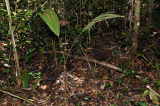
| Locality | Río Guaviare N bank, 1 km NE of Sejal, 46 km WNW of Inírida. Tropical rainforest on not-innundated, high terrace, with canopy 20-30 m tall; many slender stems and few large trees. |
| Coordinates | 3° 59' 57.4'' N 68° 19' 44.2'' W |
| Minimum elevation (m) | 110 |
| Maximum elevation (m) | 0 |
| Start date | 2009/09/08 |
| End date | 0/00/00 |
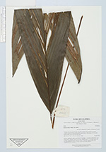
| Family | Arecaceae |
| Identification | Bactris hirta var. hirta Mart. |
| Determined by | R. Bernal & H. Balslev |
| Identification qualifier | |
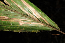
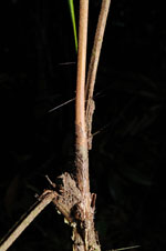
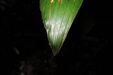
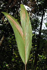
| Field notes | Solitary, understory palm; aerial stem 40 cm high, 1 cm diam; internodes 1 cm long, yellow, smooth. Leaves 4 per stem; sheaths open, 11 cm long; petiole 38 cm long, margined in cross section; rachis 35 cm long; lamina entire, flat. Transect HB1004, subunit no. 085; UTM 19N-574492-443070. |
|