| Collector | Bernal, R. |
| Number | 4467 |
| Collected with | H. Balslev, L. Mesa, D. Pedersen, J.C. Garcés, F.J. Horacio, N. Morueta, L. Skov Jensen, M. Perez |
| Country | Colombia |
| Subpart | Vichada |
| County | |
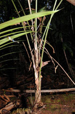
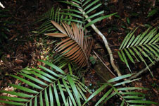
| Locality | Río Guaviare N bank, 1 km NE of Sejal, 46 km WNW of Inírida. Tropical rainforest on not-innundated, high terrace, with canopy 20-30 m tall; many slender stems and few large trees. |
| Coordinates | 3° 59' 55.4'' N 68° 19' 44.8'' W |
| Minimum elevation (m) | 110 |
| Maximum elevation (m) | 0 |
| Start date | 2009/09/08 |
| End date | 0/00/00 |
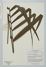
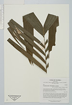
| Family | Arecaceae |
| Identification | Geonoma maxima var. maxima (Poit.)Kunth |
| Determined by | R. Bernal & H. Balslev |
| Identification qualifier | |
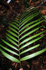
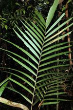
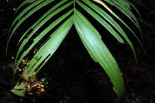
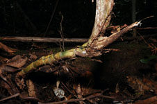
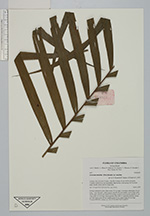
| Field notes | Solitary understory palm. Stem aerial, 30 cm long, 2 cm thick; internodes 3-4 cm long, > stem diameter, yellow-green, smooth. No crownshaft. Leaves 8 per stem; sheath open; petiole and sheath 66 cm long, round in cross section; petiole 33 cm long; rachis 61 cm long; lamina pinnate, flat, with 15, regularly inserted, pinnae per side; basal pinna 42 cm, middle pinna 35 cm, apical pinna 25 cm long. Transect HB1004, subunit no. 074; UTM 19N-574474-442017. |
|