| Collector | Bernal, R. |
| Number | 4465 |
| Collected with | H. Balslev, L. Mesa, D. Pedersen, J.C. Garcés, F.J. Horacio, N. Morueta, L. Skov Jensen, M. Perez |
| Country | Colombia |
| Subpart | Vichada |
| County | |
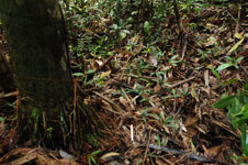
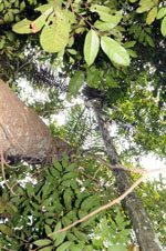
| Locality | Río Guaviare N bank, 1 km NE of Sejal, 46 km WNW of Inírida. Tropical rainforest on not-innundated, high terrace, with canopy 20-30 m tall; many slender stems and few large trees. |
| Coordinates | 3° 59' 52.6'' N 68° 19' 44.3'' W |
| Minimum elevation (m) | 109 |
| Maximum elevation (m) | 0 |
| Start date | 2009/09/08 |
| End date | 0/00/00 |
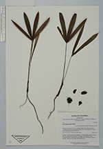
| Family | Arecaceae |
| Identification | Oenocarpus bacaba Mart. |
| Determined by | R. Bernal & H. Balslev |
| Identification qualifier | |
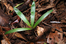
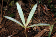
| Field notes | Seedling. The adult palm next to seedling is a solitary canopy palm with 18.5 m high, 16 cm diam stem; internodes 27 cm long, > stem diameter, grey. Crownshaft absent. Leaves 15 per stem; sheaths open, 100 cm long. Transect HB1004, subunit no. 056; UTM 19N-574489-441931. |
|
 Other records of Oenocarpus bacaba