| Collector | Bernal, R. |
| Number | 4461 |
| Collected with | H. Balslev, L. Mesa, D. Pedersen, J.C. Garcés, F.J. Horacio, N. Morueta, L. Skov Jensen, M. Perez |
| Country | Colombia |
| Subpart | Guainía |
| County | |
| Locality | Río Guaviare S bank, just south of oxbow-lake called Laguna Sejal 8 km SE of Sejal, 43 km WNW of Inírida. Tropical rain forest on floodplain, in most parts with dense understory of juvenile palms (Attalea butyracea) and overstory of 20-30 m tall trees. |
| Coordinates | 3° 55' 13.9'' N 68° 19' 3'' W |
| Minimum elevation (m) | 110 |
| Maximum elevation (m) | 0 |
| Start date | 2009/09/07 |
| End date | 0/00/00 |
| Family | Arecaceae |
| Identification | Desmoncus mitis Mart. |
| Determined by | R. Bernal & H. Balslev |
| Identification qualifier | |
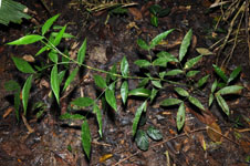
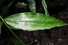
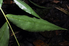
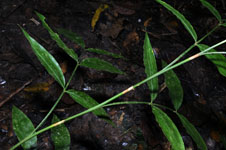
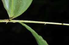
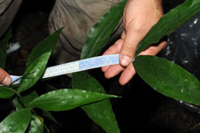
| Field notes | Cespitose, understory, liana palm. Stem aerial, 120 cm long, 0.4 cm thick; internodes 12 cm long, > stem diameter, smooth. No crownshaft. Leaves 12 per stem; sheaths 13 cm long; petiole 9 cm long; rachis 21 cm long, with 0.2 cm long, black spines: lamina pinnate, flat, with 3 pinnae per side; basal pinna 10 cm, middle pinna 18 cm, apical pinna 22 cm long. Transect HB1003, subunit no. 089; UTM 19N- (03-55-225-N lat; 68-19-048-W long). |
|
 Other records of Desmoncus mitis