| Collector | Bernal, R. |
| Number | 4458 |
| Collected with | H. Balslev, L. Mesa, D. Pedersen, J.C. Garcés, F.J. Horacio, N. Morueta, L. Skov Jensen, M. Perez |
| Country | Colombia |
| Subpart | Guainía |
| County | |
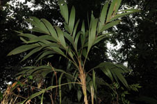
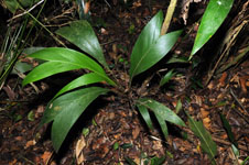
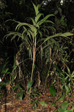
| Locality | Río Guaviare S bank, just north of oxbow-lake called Laguna Sejal 8 km SE of Sejal, 40 km WNW of Inírida. Tropical rain forest on floodplain, in parts with dense understory of palms (Bactris major) and overstory of 20-30 m tall trees, in parts with dense tangles of bamboo (Guadua sp.) |
| Coordinates | 3° 57' 58.1'' N 68° 16' 25.7'' W |
| Minimum elevation (m) | 104 |
| Maximum elevation (m) | 0 |
| Start date | 2009/09/07 |
| End date | 0/00/00 |
| Family | Arecaceae |
| Identification | Geonoma maxima var. maxima (Poit.)Kunth |
| Determined by | R. Bernal & H. Balslev |
| Identification qualifier | |
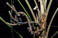
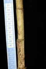
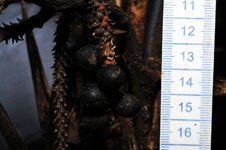
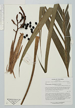
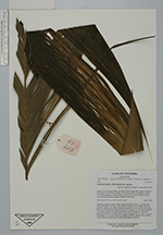
| Field notes | Cespitose, understory palm wit few visible roots. Stem aerial, 1.1 m high, 2 cm thick; internodes 7 cm long, >stem diameter, smooth. No crownshaft. Leaves 13 per stem; sheaths open; sheath and petiole margined in cross section, 44 cm long; rachis 61 cm long; lamina pinnate, flat with 3-6 segments per side; basal pinna 55 cm, middle pinna 50 cm, apical pinna 50 cm long. Infructescence interfoliar; peduncular bract 28.5 cm long, brown, papery; peduncle 32.5 cm long, 1 cm wide. Fruits black, 1.1 cm long, 1 cm wide. Transect HB1002, subunits no. 50 (UTM 19N-0580618-0438421) and 64 (UTM 19N-0580666-0438442). |
|