| Collector | Bernal, R. |
| Number | 4452 |
| Collected with | H. Balslev, L. Mesa, D. Pedersen, J.C. Garcés, F.J. Horacio, N. Morueta, L. Skov Jensen, M. Perez |
| Country | Colombia |
| Subpart | Vichada |
| County | |
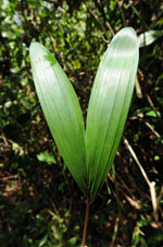
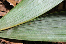
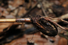
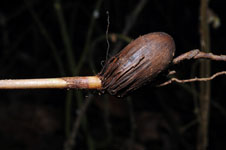
| Locality | Río Guaviare N bank, 2 km E of Sejal, 46 km WNW of Inírida. Tropical rainforest on floodplain (local name "rebalse"); canopy 20-30 m; mosaic of patches with tall trees, palm groves and Heliconia and Costus stands. |
| Coordinates | 3° 59' 15.3'' N 68° 19' 18.7'' W |
| Minimum elevation (m) | 106 |
| Maximum elevation (m) | 0 |
| Start date | 2009/09/06 |
| End date | 0/00/00 |
| Family | Arecaceae |
| Identification | Oenocarpus bataua var. bataua Mart. |
| Determined by | R. Bernal & H. Balslev |
| Identification qualifier | |
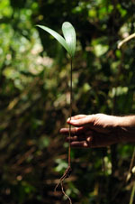
| Field notes | Seedling. Transect HB1001, outside subunit no. 045; UTM 19N-0575310-0440780 |
|