| Collector | Bernal, R. |
| Number | 4447 |
| Collected with | H. Balslev, L. Mesa, D. Pedersen, J.C. Garcés, F.J. Horacio, N. Morueta, L. Skov Jensen, M. Perez |
| Country | Colombia |
| Subpart | Vichada |
| County | |
| Locality | Río Guaviare N bank, 2 km E of Sejal, 46 km WNW of Inírida. Tropical rainforest on terra firme terrace; canopy 20-30 m; many thin stems. |
| Coordinates | 3° 59' 46.7'' N 68° 19' 17.5'' W |
| Minimum elevation (m) | 114 |
| Maximum elevation (m) | 0 |
| Start date | 2009/09/05 |
| End date | 0/00/00 |
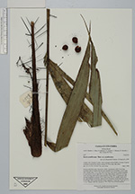
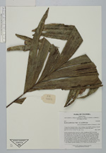
| Family | Arecaceae |
| Identification | Bactris acanthocarpa var. acanthocarpa Mart. |
| Determined by | R. Bernal & H. Balslev |
| Identification qualifier | |
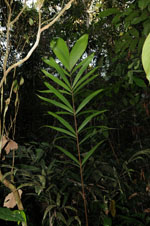
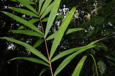
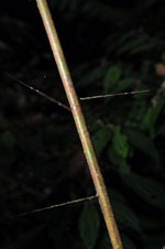
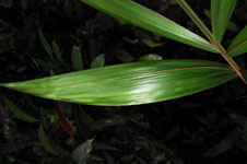
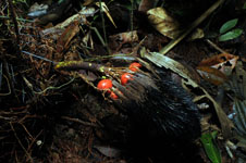
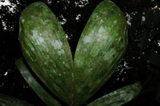
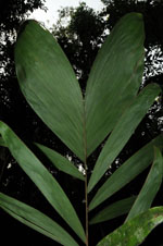
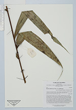
| Field notes | Solitary understory palm. Roots few visible. Acaulescent with 0.5 cm long internodes that are shorter than the stem diameter. No crownshaft. Leaves 6 per stem; sheaths open, 31 cm long, with 4 cm long, black spines; petiole margined in cross section, 66 cm long with 3 cm long, black spines; rachis 68.5 cm long with 3 cm long, black spines; lamina pinnate, bushy with 9-10 pinnae per side, inserted irregularly in groups of 1-3; basal pinna 34.5 cm, middle pinnae 26.5 cm, apical pinnae 26 cm long. Infructescence interfoliar; peduncular bract brown, 21 cm long, with 0.9 cm long black spines; peduncle 12 cm long. Fruits red, 1.6 x 1.3 cm. Transect HB1000, subunit no. 070; UTM 19N-0575332-0441660. |
|
 Other records of Bactris acanthocarpa var. acanthocarpa