| Collector | Bernal, R. |
| Number | 4446 |
| Collected with | H. Balslev, L. Mesa, D. Pedersen, J.C. Garcés, F.J. Horacio, N. Morueta, L. Skov Jensen, M. Perez |
| Country | Colombia |
| Subpart | Vichada |
| County | |
| Locality | Río Guaviare N bank, 2 km E of Sejal, 46 km WNW of Inírida. Tropical rainforest on terra firme terrace; canopy 20-30 m; many thin stems. |
| Coordinates | 3° 59' 45.9'' N 68° 19' 17.6'' W |
| Minimum elevation (m) | 114 |
| Maximum elevation (m) | 0 |
| Start date | 2009/09/05 |
| End date | 0/00/00 |
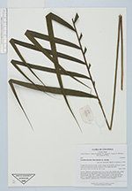
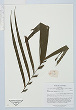
| Family | Arecaceae |
| Identification | Geonoma maxima var. maxima (Poit.)Kunth |
| Determined by | R. Bernal & H. Balslev |
| Identification qualifier | |
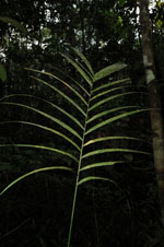
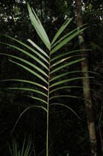
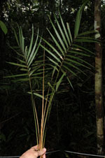
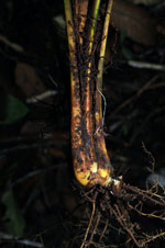
| Field notes | Solitary, understory, acaulescent palm. Leaves 8 per stem; sheaths open; sheath plus petiole 56 cm long; petiole, round in cross section; rachis 42 cm long; lamina pinnate, flat, with 11 regularly inserted pinnae on each side side, basal pinna 35 cm, middle pinna 36 cm, apical pinna 26 cm long. Sterile, juvenile. Transect HB1000, subunit no. 065; UTM 19N-0575332-0441660. |
|