| Collector | Bernal, R. |
| Number | 4444 |
| Collected with | H. Balslev, L. Mesa, D. Pedersen, J.C. Garcés, F.J. Horacio, N. Morueta, L. Skov Jensen, M. Perez |
| Country | Colombia |
| Subpart | Vichada |
| County | |
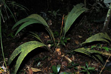
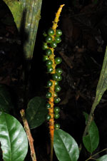
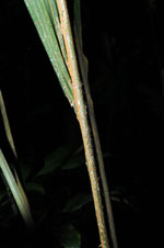
| Locality | Río Guaviare N bank, 2 km E of Sejal, 46 km WNW of Inírida. Tropical rainforest on terra firme terrace; canopy 20-30 m; many thin stems. |
| Coordinates | 3° 59' 39.2'' N 68° 19' 16.3'' W |
| Minimum elevation (m) | 114 |
| Maximum elevation (m) | 0 |
| Start date | 2009/09/05 |
| End date | 0/00/00 |
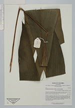
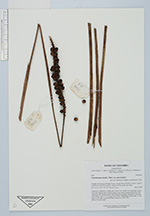
| Family | Arecaceae |
| Identification | Geonoma macrostachys var. macrostachys Mart. |
| Determined by | R. Bernal & H. Balslev |
| Identification qualifier | |
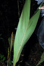
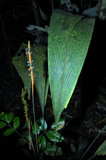
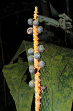
| Field notes | Understory, acaulescent, solitary palm. Roots few visible. No crownshaft. Leaves 9 per stem; sheaths open; petiole round in cross section; lamina entire, flat, with 1 pinna per side. Infructescence with herbaceous prophyll; peduncle 70 cm long, 0.4 cm thick; rachis 17.5 cm long, 0.8 cm thick, unbranched. Fruits black, 1.1 cm long, 1.0 cm wide. Transect HB1000, subunit no. 022; UTM 19N-0575332-0441660. |
|