AAU Herbarium Database |
| New Search Modify Search |
| Collector | Kukle, P. |
| Number | 125 |
| Collected with | |
| Country | Brazil |
| Subpart | |
| County | |
| Locality | Est. do Amazonas, Mun. de Manaus, Ca. 90 km N de Manaus, Distrito Agropecuário da SUFRAMA, Rodovia BR 174, km 72, depois 6 km oeste da BR, Fazenda Dimona. Projecto Dinamica Biológica de Fragmetnos Florestais, Mata de terra firmw sobre latosolo amarelo. |
| Coordinates | 2° 19' S 60° 5' W |
| Minimum elevation (m) | 50 |
| Maximum elevation (m) | 125 |
| Start date | 1989/11/28 |
| End date | 1989/11/28 |
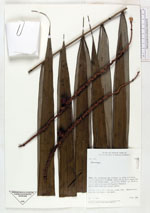
| Family | Arecaceae |
| Identification | Oenocarpus |
| Determined by | |
| Identification qualifier | |
| Field notes | 5 m tall, 6.5 cm dbh.; bark hard, ringed brown. Immature fruits borne just below base of leaf sheath. |
| |
 Other records of Oenocarpus Other records of OenocarpusThe map displays only records from the Aarhus Herbarium Database. The records may not represent the full distribution of Oenocarpus |
| New Search Modify Search |