AAU Herbarium Database |
| New Search Modify Search |
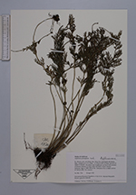
| Collector | Loc, P.K. |
| Number | CBL1720 |
| Collected with | P.H.Hoang, L.Averyanov |
| Country | Vietnam |
| Subpart | Ha Giang |
| County | |
| Locality | Distr. Dong Van, municipality Ho Quang Phin, vicinities of Ta Xa village, 14-16 km to SSW of Dong Van town. Secondary open broadleaved wet forest with remnants of primary elements on steep slopes and bluffs of karst remnant limestone ridge. |
| Coordinates | 23° 16' N 105° 22' E |
| Minimum elevation (m) | 1300 |
| Maximum elevation (m) | 1400 |
| Start date | 1999/04/28 |
| End date | 1999/04/28 |
| Family | Aspleniaceae |
| Identification | Asplenium prolongatum Hook. |
| Determined by | |
| Identification qualifier | |
| Field notes | Lithophyte fern in shady crevices of vertical cliffs. Not common. |
| |
| New Search Modify Search |