AAU Herbarium Database |
| New Search Modify Search |
| Collector | Loc, P.K. |
| Number | CBL1616 |
| Collected with | P.H. Hoang, L. Averyanov |
| Country | Vietnam |
| Subpart | Cao Bang |
| County | |
| Locality | Distr. Nguyen Binh, municipality Thai Hoc, about 5-6 km to ENE from Nguyen Binh town. Secondary ope n shrubs on steep slopes of karst remnant limestone mesae. |
| Coordinates | 22° 39' N 105° 57' E |
| Minimum elevation (m) | 500 |
| Maximum elevation (m) | 550 |
| Start date | 1999/04/21 |
| End date | 1999/04/21 |
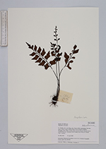
| Family | Aspleniaceae |
| Identification | Asplenium |
| Determined by | |
| Identification qualifier | |
| Field notes | Lithophyte fern on shady rock crevices on vertical cliffs. Common. |
| |
| Display all 251 georeferenced records of Asplenium Asplenium |
| New Search Modify Search |