AAU Herbarium Database |
| New Search Modify Search |
| Collector | Barbour, P.J. |
| Number | 4976 |
| Collected with | |
| Country | Peru |
| Subpart | Madre de Dios |
| County | |
| Locality | Province Tambopata: ca. 30 air km or 70-80 river km SSW Puerto Maldonado at effluence Rio La Torre (Rio D'Orbigny)/ Rio Tambopata (SE bank); Tambopata Nature Reserve; Tropical moist forest. |
| Coordinates | 12° 49' S 69° 17' W |
| Minimum elevation (m) | 260 |
| Maximum elevation (m) | 260 |
| Start date | 1980/04/25 |
| End date | 1980/04/25 |
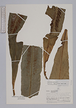
| Family | Aspleniaceae |
| Identification | Asplenium serratum L. |
| Determined by | H.v.d.Werff |
| Identification qualifier | |
| Field notes | Fertile epiphytic fern on tree bole in lagoon just above waterline. |
| |
| Display all 84 georeferenced records of Asplenium Asplenium serratum |
| New Search Modify Search |