AAU Herbarium Database |
| New Search Modify Search |
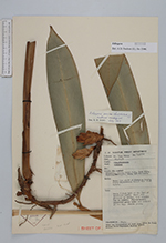
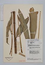
| Collector | Yii, P.C. |
| Number | S40786 |
| Collected with | |
| Country | Malaysia |
| Subpart | Sarawak |
| County | |
| Locality | Klingkang Range, Sabal F.R., 74 th mile. Kuching/Simanggang Road, 1 st Division. Below the cliff of Klengkan Range. Mixed dipterocarp forest. |
| Coordinates | |
| Minimum elevation (m) | 594.36 |
| Maximum elevation (m) | 594.36 |
| Start date | 1979/10/10 |
| End date | 1979/10/10 |
| Family | Zingiberaceae |
| Identification | Etlingera (Blume)R.M.Sm. |
| Determined by | |
| Identification qualifier | |
| Field notes | Herb 7 ft tall at the foot of sandstone cliff. Lower stem greenish in colour, leaf margine red in colour. Flower - bracts yellowish green below and reddish at the lip. Fruits green. |
| |
| This record has no coordinates. Display map with the 28 georeferenced records of Etlingera in the AAU Herbarium Database. |
| New Search Modify Search |