AAU Herbarium Database |
| New Search Modify Search |
| Collector | Stauning, O. |
| Number | 317 |
| Collected with | |
| Country | Mexico |
| Subpart | Yucatan |
| County | |
| Locality | State of YUCATAN. Municipio Valladolid. Approximately 11 km SSE of the village Xocén towards the village X-Uilub (16 QCT 8568). From old forest classified as 'nukuch kaax' by informant Celso Dzib Ay of Xocén, unless otherwise stated. |
| Coordinates | 20° 31' N 88° 7' W |
| Minimum elevation (m) | 30 |
| Maximum elevation (m) | 30 |
| Start date | 1989/07/29 |
| End date | 1989/07/29 |
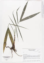
| Family | Arecaceae |
| Identification | Chamaedorea |
| Determined by | |
| Identification qualifier | |
| Field notes | Vernacular name: X-Juya. When larger such palms are used for "arcos" at chachaak ceremony. |
| |
 Other records of Chamaedorea Other records of ChamaedoreaThe map displays only records from the Aarhus Herbarium Database. The records may not represent the full distribution of Chamaedorea |
| New Search Modify Search |