AAU Herbarium Database |
| New Search Modify Search |
| Collector | Stauning, O. |
| Number | 128 |
| Collected with | |
| Country | Mexico |
| Subpart | Yucatan |
| County | |
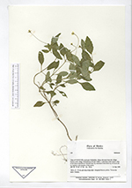
| Locality | State of YUCATAN, municipio Valladolid. Along old track from the village Xocén to the village Tixhualactun (16 QCT 8081). From narrow strip of tall forest classified as 'nukuch kaax' by informant Celso Dzib Ay of Xocén. It looked more like a t'olche' fence to me. |
| Coordinates | 20° 37' N 88° 9' W |
| Minimum elevation (m) | 40 |
| Maximum elevation (m) | 40 |
| Start date | 1989/09/12 |
| End date | 1989/09/12 |
| Family | Asteraceae |
| Identification | Asteraceae |
| Determined by | |
| Identification qualifier | |
| Field notes | Herb, 15 - 50 cm, growing along track. Marginal flowers yellow. Vernacular name: Joljatun. |
| |
| Display all 319 georeferenced records of Asteraceae |
| New Search Modify Search |