AAU Herbarium Database |
| New Search Modify Search |
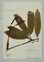
| Collector | Tirado, M. |
| Number | 886 |
| Collected with | B.Gray |
| Country | Ecuador |
| Subpart | Zamora-Chinchipe |
| County | |
| Locality | Nangaritza. Cordillera del Cóndor. Campamento militar Pachicutza, camino al hito. Bosque muy húmedo montano bajo. Bosque primario. Bosque con dosel de 25-30 m de altura. |
| Coordinates | 4° 7' 17'' S 28° 54' 17'' W |
| Minimum elevation (m) | 1849 |
| Maximum elevation (m) | 1849 |
| Start date | 1994/02/22 |
| End date | 1994/02/22 |
| Family | Araliaceae |
| Identification | Sciodaphyllum P. Browne |
| Determined by | Dr. Pete Lowry |
| Identification qualifier | |
| Field notes | Árbol de 10 m de altura. Frutos verdes. |
| |
| Display all 81 georeferenced records of Sciodaphyllum Sciodaphyllum |
| New Search Modify Search |