AAU Herbarium Database |
| New Search Modify Search |
| Collector | Lewis, M. |
| Number | 40776 |
| Collected with | |
| Country | Bolivia |
| Subpart | La Paz |
| County | |
| Locality | Inquisivi. "Tableria" - - The maps are nearly blank in this area, but from the actual site of Estancia Aguilani (which is misplaced on map) following the slope south of the Río Aguilani ca 1.2 km, one crosses a river flowing from the ridge of Cerro Lulini. Crossing the river and climbing the lower part of this ridge is the area locally known as Tableria. 15 km N. of Choquetanga. After climbing up through head high fern heath, one comes to the top edge of some evergreen ravine forests. |
| Coordinates | 16° 42' S 67° 19' W |
| Minimum elevation (m) | 2400 |
| Maximum elevation (m) | 2500 |
| Start date | 1991/12/02 |
| End date | 1991/12/02 |
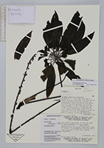
| Family | Araliaceae |
| Identification | Sciodaphyllum P. Browne |
| Determined by | Dr. Pete Lowry |
| Identification qualifier | |
| Field notes | Hemiepiphyte, strangler-type over trees in forest. Inflorescence long and spike like in group of four with leaves underneath. |
| |
| Display all 81 georeferenced records of Sciodaphyllum Sciodaphyllum |
| New Search Modify Search |