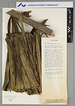
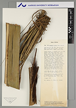
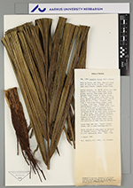
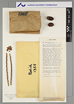
| Field notes | Palm solitary, dbh 30cm, 20m tall with mass of prop roots at base. In semi-open palm forest, common, terra firme. Leaves pinnate, ea. 88-90 pinnae per side sheath 1. 25m long x 60cm wide, olive green; petiole 70cm long; with stiff upright brown fibers at base; rachis 9m long. Basal pinna 1.62m long x 4cm wide; middle pinna 1. 7m x 14cm; apical pinna 90 cm x 2. 5cm. Prophyll 70cm long x 13'cm wide; bract almost ready to open, 1. 6m long. Primary axis of inflorescence 23cm to first bract scar, 27 .5 cm from apex to prophyll scar; apical rachillae 80-90cm long; middle rachillae 80-85 cm long; basal rachillae ea. 80cm long. Very heavily fruited, 25-36-36-38-39-42 fruits per rachilla. Flowers collected from another tree, ripe fruits from another tree as the two panicles on this tree are unripe. Local name and use: "majo", fruits eaten, and to make beverage and oil. First record of this genus in Bolivia |