AAU Herbarium Database |
| New Search Modify Search |
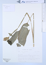
| Collector | Hagberg, M. |
| Number | 357 |
| Collected with | E-L. Medin |
| Country | Peru |
| Subpart | Ucayali |
| County | |
| Locality | Bosque Nacioal Alexander von Humboldt. At km 86 on road Pucallpa - Tingo Maria. In the Rodal Semillero 1-2km N rd. Partly disturbed forest w. ± cleared understory. Along path. |
| Coordinates | 8° 46' S 75° 19' W |
| Minimum elevation (m) | 400 |
| Maximum elevation (m) | 400 |
| Start date | 1987/02/09 |
| End date | 1987/02/09 |
| Family | Marantaceae |
| Identification | Ctenanthe |
| Determined by | |
| Identification qualifier | |
| Field notes | Rhizomes brenched to form clusters of several shoots, to 1m total height. Each shoot w. a few basal leaves. Leaves subchartaceus, green on both sides. Spathes green. |
| |
 Other records of Ctenanthe Other records of CtenantheThe map displays only records from the Aarhus Herbarium Database. The records may not represent the full distribution of Ctenanthe |
| New Search Modify Search |