AAU Herbarium Database |
| New Search Modify Search |
| Collector | Hagberg, M. |
| Number | 356 |
| Collected with | E-L. Medin |
| Country | Peru |
| Subpart | |
| County | |
| Locality | Ucayali. Bosque Nacional Alexander von Humboldt. At Km 86 on Road Pucallpa - Tingo Maria. In the Rodal Semillero 1-2km N rd. Paartly disturbed forest w. ± cleared understory. Along streamlet, on greyish sandy soil. |
| Coordinates | 8° 46' S 75° 19' W |
| Minimum elevation (m) | 400 |
| Maximum elevation (m) | 400 |
| Start date | 1987/02/09 |
| End date | 1987/02/09 |
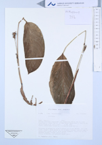
| Family | Marantaceae |
| Identification | Calathea |
| Determined by | |
| Identification qualifier | |
| Field notes | Rhizomes brenched to form clsters of a few shoots, to 0.3m total height. Each shootw. 1-2 basal leaves. Leaves papyraceus, light green above, grey green beneath. Fulvinus olive. Spathes green. Flower parts white. |
| |
 Other records of Calathea Other records of CalatheaThe map displays only records from the Aarhus Herbarium Database. The records may not represent the full distribution of Calathea |
| New Search Modify Search |