AAU Herbarium Database |
| New Search Modify Search |
| Collector | Hagberg, M. |
| Number | 343 |
| Collected with | E-L. Medin |
| Country | Peru |
| Subpart | Madre de Dios |
| County | |
| Locality | Manú Province. C. 5km of Salvacion. C.0.3km NW of hacienda Quinta Erika. Disturbed primary forest on terra firme. On reddish clay. |
| Coordinates | 12° 54' S 71° 14' W |
| Minimum elevation (m) | 600 |
| Maximum elevation (m) | 600 |
| Start date | 1987/01/24 |
| End date | 1987/01/24 |
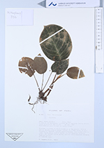
| Family | Marantaceae |
| Identification | Calathea |
| Determined by | |
| Identification qualifier | |
| Field notes | Rhizomes brenched to form clumps w. a few shoots. Mature aerial shoots without basal leaves, to 0.25m total height. Cataphylla reddish. Leaves subchartaceus, dark green with a light field along midrib above, violet beneath. Spathes green. All flower parts white. Mature inflorescences bending towards ground. |
| |
 Other records of Calathea Other records of CalatheaThe map displays only records from the Aarhus Herbarium Database. The records may not represent the full distribution of Calathea |
| New Search Modify Search |