AAU Herbarium Database |
| New Search Modify Search |
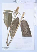
| Collector | Hagberg, M. |
| Number | 338 |
| Collected with | E-L. Medin |
| Country | Peru |
| Subpart | Cuzco |
| County | |
| Locality | Paucartambo Prov. 1km N. of Pillcopata at sitio Villa Carmen. Secundary shrubs. |
| Coordinates | 13° 15' S 71° 12' W |
| Minimum elevation (m) | 800 |
| Maximum elevation (m) | 800 |
| Start date | 1987/01/20 |
| End date | 1987/01/20 |
| Family | Marantaceae |
| Identification | Ctenanthe |
| Determined by | |
| Identification qualifier | |
| Field notes | Rhizomes brenched to form clumps w. up to c. 10 shoots. Aerial shoots w. c.4-5 basal leaves, to c.1.7m total height. Leaves chartaceus, scalloped, dark green above, grey green beneath. Pulvinus olive. Spathes green. Sepals greenish white; corolla tube, lobes outer and cucullate staminodes white; callose staminode white w. blueish tip. |
| |
 Other records of Ctenanthe Other records of CtenantheThe map displays only records from the Aarhus Herbarium Database. The records may not represent the full distribution of Ctenanthe |
| New Search Modify Search |