| Collector | Blasco, M. |
| Number | 1796 |
| Collected with | |
| Country | Ecuador |
| Subpart | NAPO |
| County | |
| Locality | Tiputini river, 3 h. upriver from the bridge on the Coca road. Primary rainforest. |
| Coordinates | 0° 44' S 76° 58' W |
| Minimum elevation (m) | 250 |
| Maximum elevation (m) | 300 |
| Start date | 1991/07/21 |
| End date | 1991/07/22 |
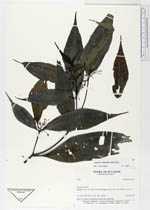
| Family | Melastomataceae |
| Identification | Miconia chaetodonta R.Goldenb. & Michelang. |
| Determined by | Elvira Cotton |
| Identification qualifier | |
| Field notes | Shrub (?), flowers white-green, fruits blue and round. |
|
 Other records of Miconia chaetodonta