AAU Herbarium Database |
| New Search Modify Search |
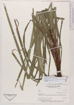
| Collector | Blasco, M. |
| Number | 1793 |
| Collected with | |
| Country | Ecuador |
| Subpart | NAPO |
| County | |
| Locality | Tiputini river, 3 h. upriver from the bridge on the Coca road. Primary rainforest. |
| Coordinates | 0° 44' S 76° 58' W |
| Minimum elevation (m) | 250 |
| Maximum elevation (m) | 300 |
| Start date | 1991/07/21 |
| End date | 1991/07/22 |
| Family | Cyperaceae |
| Identification | Calyptrocarya |
| Determined by | Blasco, M. (AAU), 1993. |
| Identification qualifier | |
| Field notes | Herbaceous plant up to 70 cm high. |
| |
 Other records of Calyptrocarya Other records of CalyptrocaryaThe map displays only records from the Aarhus Herbarium Database. The records may not represent the full distribution of Calyptrocarya |
| New Search Modify Search |