| Collector | Chatrou, L.W. |
| Number | 362 |
| Collected with | Pirie, M.D.; Saucedo,A. |
| Country | Bolivia |
| Subpart | Beni |
| County | |
| Locality | Vaca Diez, San Pablo, 45 km northeast of Riberalta along road to Cachuela Esperanza. Disturbed forest on tierra firme |
| Coordinates | 10° 37' S 65° 46' W |
| Minimum elevation (m) | 250 |
| Maximum elevation (m) | 250 |
| Start date | 2001/11/02 |
| End date | 2001/11/02 |
| Family | Annonaceae |
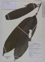
| Identification | Guatteria megalophylla Diels |
| Determined by | Chatrou, L.W. 2001. Maas & Westra 2011 |
| Identification qualifier | |
| Field notes | Treelet, 3.5 m tall, 2.5 cm in diam., sterile |
|
 Other records of Guatteria megalophylla