AAU Herbarium Database |
| New Search Modify Search |
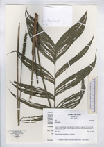
| Collector | Kvist, L.P. |
| Number | 602 |
| Collected with | L. Freitas A. |
| Country | Peru |
| Subpart | Loreto |
| County | |
| Locality | Jenaro Herrera. Along the lower Ucayali river, approx. 7 km west of the Jenaro Herrera village, Zona de Braga. Research area where permanent plots 1-4 and 8-9 are located. |
| Coordinates | 4° 55' S 73° 45' W |
| Minimum elevation (m) | 120 |
| Maximum elevation (m) | 120 |
| Start date | 1993/11/15 |
| End date | 1993/11/15 |
| Family | Arecaceae |
| Identification | Geonoma |
| Determined by | |
| Identification qualifier | |
| Field notes | Scattered small populations at "restingas" |
| |
| Display all 68 georeferenced records of Geonoma Geonoma |
| New Search Modify Search |