AAU Herbarium Database |
| New Search Modify Search |
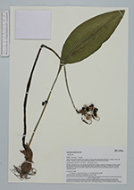
| Collector | Kvist, L.P. |
| Number | 554 |
| Collected with | L.Jensen, Thirup |
| Country | Peru |
| Subpart | Loreto |
| County | |
| Locality | Along the lower Ucayali river, approx. 7 km west of the Jenaro Herrera village, "Zona de Braga". Research area where permanent plots 1-4 and 8-9 are located. Moostly natural levees, maximally flooded a few months annually (restinga), but traversed by several metres lower areas (bajiales)often inundated more than a half year anually. Flooded by a mixture of white water from the Ucayali river and black water from local upland streams. |
| Coordinates | 4° 55' S 73° 45' W |
| Minimum elevation (m) | 120 |
| Maximum elevation (m) | 120 |
| Start date | 1993/09/15 |
| End date | 1993/10/30 |
| Family | Amaryllidaceae |
| Identification | Eucharis |
| Determined by | H.Christensen |
| Identification qualifier | |
| Field notes | |
| |
 Other records of Eucharis Other records of EucharisThe map displays only records from the Aarhus Herbarium Database. The records may not represent the full distribution of Eucharis |
| New Search Modify Search |