| Collector | Kvist, L.P. |
| Number | 1545 |
| Collected with | |
| Country | Peru |
| Subpart | Loreto |
| County | |
| Locality | Along the lower Ucayali river, approx. 8 km southwest of the large village Jenaro Herrera, the channal Lobillo fairly close to the village Nuevo Aucayacu. |
| Coordinates | 4° 57' S 73° 45' W |
| Minimum elevation (m) | 120 |
| Maximum elevation (m) | 120 |
| Start date | 1995/03/22 |
| End date | 1995/03/22 |
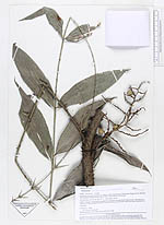
| Family | Arecaceae |
| Identification | Desmoncus polyacanthos Mart. |
| Determined by | A. Henderson |
| Identification qualifier | |
| Field notes | Light-exposed vegetation along bank of channal through flood plain forest. Flooded by a mixture of black water from local upland streams and white water from the Ucayali river. Climbing. |
|