AAU Herbarium Database |
| New Search Modify Search |
| Collector | Kvist, L.P. |
| Number | 1449 |
| Collected with | |
| Country | Peru |
| Subpart | Loreto |
| County | |
| Locality | Along the lower Ucayali river, approx. 8 km northwest of Jenaro Herrera, the flood plain village Casa Grande. Slash-and-burn field south of village, also a few collections along the bank of the river and from garden in Casa Grande |
| Coordinates | 4° 49' S 73° 43' W |
| Minimum elevation (m) | 120 |
| Maximum elevation (m) | 120 |
| Start date | 1995/03/17 |
| End date | 1995/03/17 |
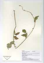
| Family | Fabaceae |
| Identification | Phaseolus L. |
| Determined by | Ulrika Ridbäck |
| Identification qualifier | |
| Field notes | Herb, yellow-green flowers |
| |
 Other records of Phaseolus Other records of PhaseolusThe map displays only records from the Aarhus Herbarium Database. The records may not represent the full distribution of Phaseolus |
| New Search Modify Search |