| Collector | Kvist, L.P. |
| Number | 1234 |
| Collected with | |
| Country | Peru |
| Subpart | Loreto |
| County | |
| Locality | Lower Ucayali river, approx. 7 km west of Jenaro Herrera, along the channal of Supay between Sahua lake and its confluence with river. |
| Coordinates | 4° 55' S 73° 43' W |
| Minimum elevation (m) | 120 |
| Maximum elevation (m) | 120 |
| Start date | 1994/10/10 |
| End date | 1994/10/10 |
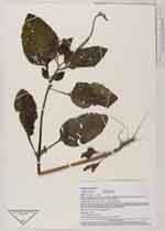
| Family | Boraginaceae |
| Identification | Heliotropium indicum L. |
| Determined by | Frederico Luebert, Berlin |
| Identification qualifier | |
| Field notes | Herb community along channal. Only exposed up to three months annually from August to October. The rest of the year flooded up to 10 meters by a mixture of white water from the Ucayali river and black water from local upland streams. Herb, ca 80 cm. tall, flowers pale blue |
|
 Other records of Heliotropium indicum