AAU Herbarium Database |
| New Search Modify Search |
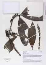
| Collector | Kvist, L.P. |
| Number | 1161 |
| Collected with | |
| Country | Peru |
| Subpart | Loreto |
| County | |
| Locality | Along the lower Ucayali river, approx. 7 km west of the Jenaro Herrera, “Zona de Braga”. In or near plot 1,8 and 9 (of nine 100 x 100 meters large permant plots). All plots located at nearby natural levees maximally flooded a few months annually (restinga), but traversed by several metres deeper ravines (bajiales) often flooded more than a half year annually. Flooded by a mixture of white water from the Ucayali river and black water from local upland streams |
| Coordinates | 4° 55' S 73° 45' W |
| Minimum elevation (m) | 120 |
| Maximum elevation (m) | 120 |
| Start date | 94/08/29 |
| End date | 94/08/31 |
| Family | Myrsinaceae |
| Identification | Stylogyne |
| Determined by | L.P.Kvist |
| Identification qualifier | |
| Field notes | Treelet, 6 m. tall ( DAB ca 5 cm.), berries purple to black |
| |
 Other records of Stylogyne Other records of StylogyneThe map displays only records from the Aarhus Herbarium Database. The records may not represent the full distribution of Stylogyne |
| New Search Modify Search |