AAU Herbarium Database |
| New Search Modify Search |
| Collector | Kvist, L.P. |
| Number | 1151 |
| Collected with | |
| Country | Peru |
| Subpart | Loreto |
| County | |
| Locality | In or near plot 2, 3 and 4 (of nine 100 x 100 metres large permanent plots). Plots located at large and fairly plain old natural levee maximally flooded a few months annually (restinga). Flooded by mixture of black wateer from local upland streams and white water from the Ucayali river. |
| Coordinates | 4° 55' S 73° 45' W |
| Minimum elevation (m) | 120 |
| Maximum elevation (m) | 120 |
| Start date | 1994/08/20 |
| End date | 1994/08/27 |
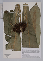
| Family | Aspleniaceae |
| Identification | Asplenium serratum L. |
| Determined by | B.Ollgaard |
| Identification qualifier | |
| Field notes | Epiphytic. |
| |
| Display all 84 georeferenced records of Asplenium Asplenium serratum |
| New Search Modify Search |