AAU Herbarium Database |
| New Search Modify Search |
| Collector | Kvist, L.P. |
| Number | 1147 |
| Collected with | |
| Country | Peru |
| Subpart | Loreto |
| County | |
| Locality | Along the lower Ucayali river, approx. 7 km west of the Jenaro Herrera village, "Zona de Braga". In or near plot 2, 3 and 4 (of nine 100x100 metres large permanent plots). Plots located at large and fairly plain old natural levee maximally flooded a few months anually (restinga). Flooded by a mixture of black water from local upland streams and white water from the Ucayali river. |
| Coordinates | 4° 55' S 73° 45' W |
| Minimum elevation (m) | 120 |
| Maximum elevation (m) | 120 |
| Start date | 1994/08/24 |
| End date | 1994/08/27 |
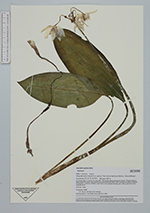
| Family | Amaryllidaceae |
| Identification | Eucharis |
| Determined by | L.P.Kvist |
| Identification qualifier | |
| Field notes | Flowers white. |
| |
 Other records of Eucharis Other records of EucharisThe map displays only records from the Aarhus Herbarium Database. The records may not represent the full distribution of Eucharis |
| New Search Modify Search |